Saturday forecast as of Friday 2/1/19 5pm for 11,000':
- Mostly sunny, with a high near 36. Windy, with a west wind 25 to 30 mph, with gusts as high as 48 mph (see graph panel below left and corresponding map).
- Check Niwot treeline (11,000') for latest NWS point forecast
Avi Center (CAIC)
- Colorado 11,000' forecast.
For the weekend (as of Friday 12noon), with
discussion of upper air height patterns:
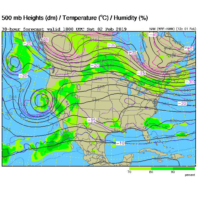
- Upper level flow will turn
southwesterly tonight [Friday] ahead of a
low pressure trough (see map 2nd row, left: 11am
MST, 2 Feb 500mb heights).
Clouds will move in on Saturday.
Temperatures remain fairly warm, and winds will be
increasing from the southwest.
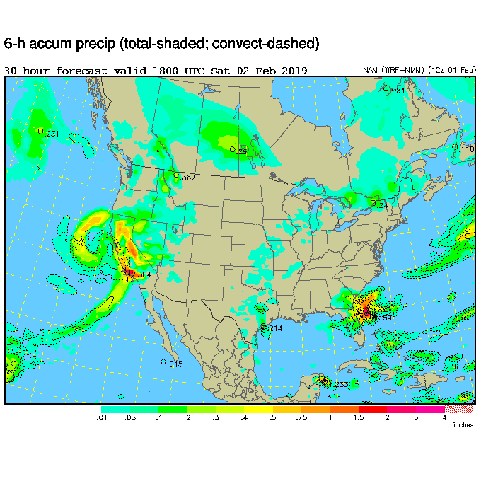
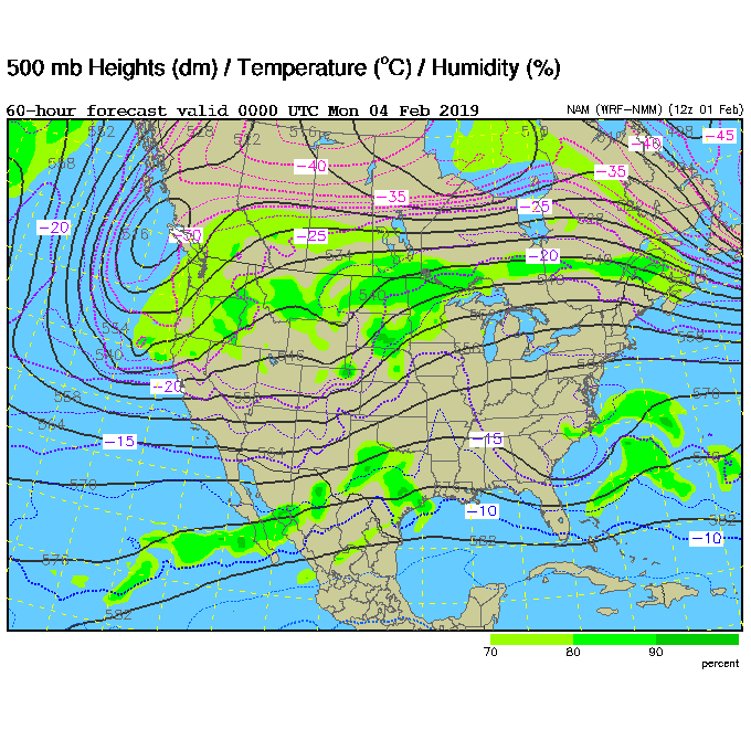
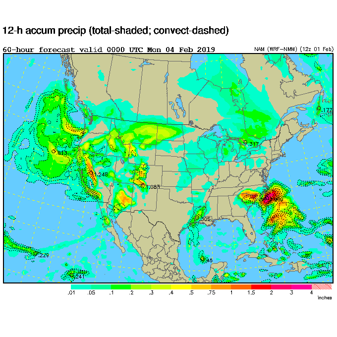
- Snow showers should start in the evening [Saturday], and begin in earnest after midnight. It looks like this initial wave (see map last row, left: for 5pm MST, 3 Feb 500mb heights) will bring a decent, if fast moving, shot of snow [for Sunday] (see map last row, right: for 5pm MST, 3 Feb precipitation). Light snowfall and unsettled weather continues until a second, and possibly stronger, storm arrives Monday-Tuesday.
Forecast for Sunday
as of Friday 2/1/19, 6pm:
- Allenspark
(8400' elev): A 30
percent chance of snow showers, mainly after 11am.
Partly sunny, with a high near 45. Breezy, with a
west southwest wind 11 to 16 mph increasing to 18
to 23 mph in the afternoon. Winds could gust as
high as 37 mph.
- Wild
Basin (9200'): A 40 percent chance of snow showers.
Partly sunny, with a high near 42. Breezy, with a
west southwest wind 16 to 23 mph, with gusts as high
as 37 mph.
| Niwot treeline (11,000') Point Forecast |
Forecast Map
for 11am MST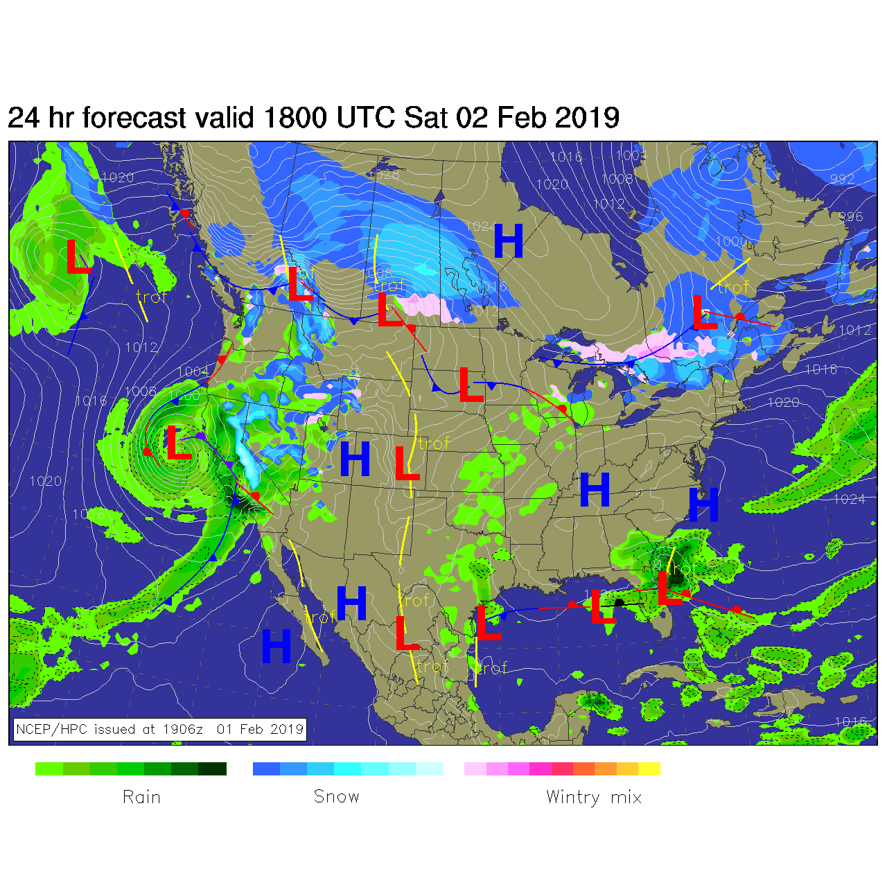 |
 |
 |
 |
 |