
Why this ? An early dbSEABED mapping computed
using the Canadian SPANS quadtree GIS

|

Based at:
Institute of Arctic & Alpine
Research (INSTAAR)
University
of Colorado at Boulder
1560
30th Street
Campus Box
450
Boulder CO,
80309-0450 Tel: +1 720 840 3303, Fax:
+1 303 492 6388 | Research fields:
Ocean floor Sedimentology, Geophysics and Stratigraphy
Machine Understanding of Word-Based Data
Materials and Features of the Global Seabed
Advanced Computing for Heterogeneous Seabed Data
Modelling Seafloor Processes under Extreme Events
Concurrent:
 Senior Research Scientist in Environmental Computing,
INSTAAR, Senior Research Scientist in Environmental Computing,
INSTAAR,
University of Colorado Boulder, Boulder, USA
 Visiting
Research Fellow, School of Biological Sciences, Visiting
Research Fellow, School of Biological Sciences,
University of Adelaide, Adelaide, Australia
Professional pages:
ResearchGate LinkedIn
|
Research
Programs
- dbSEABED - an Information
System of the World's Seafloor
Seabed
information processing leading to mappings on local to global scales;
development of new data mining and linguistic processes, development of
GIS visualizations for seabed data. The mappings support many
sister-projects in geology, ecology, fisheries, biogeochemistry,
engineering, human impacts, and others.
|
|
- Population Modelling of Carbonate Sediment/Rock Facies
Carbonate
sediments and rocks are mostly biogenic in origin, formed from the
growth and turnover of populations of organisms. Population models
should be able to model the facies of carbonate accumulation in detail
and accurately. |
Carbo*
 | - Application of Computational Methods to Seafloor Information
Information
about the seabed - its materials, features, properties - is both
numerical and linguistic in nature. The linguistic, descriptive,
word-based data is most important to achieve wide-area mappings, but
requires the use of Natural Language Processing, Machine Learning and
'soft computing' such as Fuzzy Set Theory.
|

| - Seabed Sedimentology with Engineering Applications
The
combination of huge amounts of detailed seabed data with geological and
geophysical models, plus modern visualization technologies such as GIS
assists multiple projects in seafloor object burial, acoustic
propagation, and slope stability. Extreme events such as
hurricanes, require different methods of modeling, especially because
phase transitions of processes occur.
| -
  | - Seamless over the Strandline
One
of the great data divides in geosciences is between the substrates and
habitats of the land (soils, agriculture) and the marine (sediments,
oceanography). This project devised some new computing methods for
reconciling the two data domains. It produced joined maps for Louisiana.
| |
|
Appointments, Experience
- Senior Research Scientist and Fellow in
Environmental Computing, INSTAAR,
Univ. Colorado, 2002-
- Senior Research Fellow in Marine Geosciences, Ocean
Sciences Institute, Sydney
Univ, 1991-2001
- Consultancies and secondments with agencies and
companies, 1985-.
Prediction
for engineers of extreme events at seabed, providing regional mappings
of ocean-floor characteristics, marine geophysical acquisition,
multibeam surveying,
marine
error analysis, marine tailings disposal monitoring, marine platform
foundations sampling and analysis, linguistic data processing in
geology, shipboard database/GIS systems, deep seafloor sediment
sampling and photography, marine shallow seismic interpretation.
- Research Fellow in Marine Geosciences, Ocean Sciences
Institute, Sydney Univ.,
1983-90
- Assistant Lecturer, Tutor in Stratigraphy, Australian
National University and James Cook University, 1980-1982.
- PhD (Cambridge,
UK) 1979
with Sidney Sussex College Scholarship for postgraduate study.
- BSc Hons (Sydney, Australia) 1974
with various scholarships and awards.
Teaching
- Australian National University 1980-81: Stratigraphy-palaeontology Year II
- James Cook University 1982: Stratigraphy-palaeontology Year II
- University of Sydney: ~1990, 1992: Introductory Oceanography Year I
- University of Colorado, Boulder ~2009, 2012: Advanced Oceanography Year III
- University of Colorado, Boulder 2012: Introductory Oceanography Year I
|
Committee Service- Co-chair,
Artificial Intelligence & Machine Learning Initiative,
Community Earth Surface Dynamics Modeling System (CSDMS), 2018-
See
the Initiative and Conversations Portal at
"https://csdms.colorado.edu/wiki/AI-ML" and
"https://csdms.colorado.edu/wiki/AIML_Conversations". - Member, Steering Committee of the NSF-funded Paleogeosciences Research Coordination Network (C4P RCN), 2016-
- Co-Chair,
Carbonate Focus Research Group (C-FRG) in the NSF-supported Community
Earth Surface Dynamics Modeling System (CSDMS), 2016-
- Member, NSF-supported Earthcube committee for organization of the 2016 All-Hands Meeting, in Denver July 2016.
|
|
In The Pipeline (In Press, Accepted, or Submitted) - Lu, X., Saul, S. & Jenkins, C. (Submitted.) Statistical methods
for predicting the spatial abundance of reef fish species Integrating
machine learning approaches for predicting spatial abundance of reef
fish species. Methods in Ecology and Evolution (Paper)
- Jenkins, C.J. (Submitted) Time Statistics for Seabed Elevation Changes and UXO Burial/Unburial, German North Sea. (Paper)
Papers (Published, Peer Reviewed)
- Harris, C.K.,
Syvitski, J., Arango, H.G., Meiburg, E. H., Cohen, S., Jenkins, C.J.,
Birchler, J.J., Hutton, E.W.H., Kniskern, T.A., Radhakrishnan, S. and
Auad, G. 2020. Data-driven, multi-model workflow suggests strong
influence from
hurricanes on the generation of turbidity currents in the Gulf of
Mexico.Journal of Marine Science and Engineering,
https://doi.org/10.3390/jmse8080586
- Börker,
J., Hartmann, J., Amann, T., Romero‐Mujalli, G., Moosdorf, N., Jenkins,
C. 2020. Chemical Weathering of Loess and Its Contribution to Global
Alkalinity Fluxes to the Coastal Zone During the Last Glacial Maximum,
Mid‐Holocene, and Present. Geochemistry, Geophysics, Geosystems,
21(7):-. [https://onlinelibrary.wiley.com/doi/10.1029/2020GC008922]
DOI: 10.1029/2020GC008922
- Jenkins,
C.J. & Papili, S. 2020. Potential UXO seabed migration in the
German Bight. Hydrographische Nachrichten HN 116 — 06/2020, 72-76.
[DOI: 10.23784/HN116-11]
- Brewin, P.E., Farrugia, T.J., Jenkins, C., Brickle, P. 2020. Straddling
the line: high potential impact on vulnerable marine ecosystems by
bottom-set longline fishing in unregulated areas beyond national
jurisdiction, ICES Journal of Marine Science, , fsaa106,
https://doi.org/10.1093/icesjms/fsaa106
- Sulpis,O.,
Boudreau. B.P., Mucci, A, Jenkins, C., Trossmane, D.S,
Arbic, B.K. & Key, R.M. 2018. Current CaCO3 dissolution at
the seafloor caused by anthropogenic CO2.
["https://doi.org/10.1073/pnas.1804250115"]
- Amoroso,
R.O., Pitcher, C.R., Rijnsdorp, A.D., McConnaughey, R.A., Parma, A.M.,
Suuronen, P., O.R. Eigaard, F.Bastardie, N.T. Hintzen, F. Althaus, S.J.
Baird, J. Black, L. Buhl-Mortensen, A.B. Campbell, R. Catarino, J.
Collie, J.H. Cowan Jr., D. Durholtz, N. Engstrom, T.P. Fairweather,
H.O. Fock, R. Ford, P.A. Gálvez, H. Gerritsen, M.E. Góngora, J.A.
González, J.G. Hiddink, K.M. Hughes, S.S. Intelmann, C. Jenkins, P.
Jonsson, P. Kainge, M. Kangas, J. N. Kathena, S. Kavadas, R.W. Leslie,
S.G. Lewis, M. Lundy, D. Makin, J. Martin, T. Mazor, G.
Gonzalez-Mirelis, S.J. Newman, N. Papadopoulou, P.E. Posen, W.
Rochester, T. Russo, A. Sala, J.M. Semmens, C. Silva, A. Tsolos, B.
Vanelslander, C.B. Wakefield, B.A. Wood, R. Hilborn, M. J. Kaiser,
& S. Jennings 2018. Bottom trawl fishing footprints on the world’s
continental shelves. PNAS, "https://doi.org/10.1073/pnas.1802379115"
- Bostock,
H., Jenkins, C., Mackay, K., Carter, L., Nodder, S., Orpin, A.,
Pallentin, A. & Wysoczanski, R. 2018b. Distribution of
surficial sediments in the ocean around New Zealand/Aotearoa. Part B:
Continental shelf. New Zealand Journal of Geology and Geophysics, "doi.org/10.1080/00288306.2018.1523199".
- Bostock,
H., Jenkins, C., Mackay, K., Carter, L., Nodder, S., Orpin, A.,
Pallentin, A. & Wysoczanski, R. 2018a. Distribution of surficial
sediments in the ocean around New Zealand/Aotearoa. Part A: Continental
slope and deep ocean. New Zealand Journal of Geology and Geophysics, "DOI: 10.1080/00288306.2018.1523198".
- Harris, C. K.; Syvitski, J. P.; Arango, H.; Meiburg, E. H.; Auad, G.;
Cohen, S.; Hutton, E.; Jenkins, C. J.; Kniskern, T. A.; Radhakrishnan,
S. 2018. (Abstract) Toward Quantifying the Influence of Hurricanes on
Generating Turbidity Currents in the Gulf of Mexico: A Multi-model
Workflow. American Geophysical Union, Fall Meeting 2018, abstract
#EP53B-22 [Here]
- Sulpis,
O., Boudreau, B., Mucci, A., Dufour, C., Jenkins, C., Trossman, D.,
Arbic, B. & Key, R. 2018. (Abstract) Bottom-Water Acidification and
CaCO3 Dissolution at the Seafloor Caused by Anthropogenic CO2. Goldschmidt Abstracts, 2018 2440. [Here]
- Jenkins, C.J. 2018. Sediment Accumulation Rates For The Mississippi Delta Region: A Time-Interval Synthesis. Journal of Sedimentary Research (2018) 88 (2): 301-309 [https://doi.org/10.2110/jsr.2018.15]
- Jenkins, C.J. 2017. (Abstract) Fast-marching methods to model the acoustic responses of biological seafloors. The Journal of the Acoustical Society of America 142, 2666. [https://doi.org/10.1121/1.5014716]
- Diesing,
M., Kröger, S., Parker, R., Jenkins, C., Mason, C.
& Weston, K. 2017. Predicting the standing stock of
organic carbon in surface sediments of the North-West European
continental shelf. Biogeochemistry 135(1–2), 183–200. [HERE]
- Wever, T. & Jenkins, C. 2017. Physik biologisch besiedelter Meeresböden. Hydrographische Nachrichten 106(02), 6-11. ["Physics of biologically populated seabeds" English translation]
- Jenkins,
C., Syvitski, J., Meiburg, E., Harris, C.K., Arango, H., Auad, G.,
Hutton, E., Kniskern, T., Radhakrishnan, S. & Birchler,
J. 2016. (Poster) Modelling Extreme Events (Hurricanes) At The
Seafloor In The Northern Gulf Of Mexico. Geological Society of America Abstracts with Programs. 48(7), doi: 10.1130/abs/2016AM-284913. [Here]
- Syvitski,
J.P.M., Arango, H.G., Harris, C.K., Meiburg, E.H., Jenkins, C.J.,
Hutton, E.W.H., Auad G. and Xing F. 2016. (Keynote Speech Abstract)
Modeling of Sediment Transport in the Gulf of Mexico due to the
Influence of Hurricanes. Second Conference on Forward Modelling of Sedimentary Systems, Session: From Mathematical Modelling to Numerical Code, DOI: 10.3997/2214-4609.201600387. [Here]
- Syvitski,
J. P., Jenkins, C. J., Meiburg, E. H., Radhakrishnan, S.,
Harris, C. K., Arango, H., Kniskern, T. A., Hutton, E., Auad, G. 2016.
(Abstract) Modelling Extreme Events (Hurricanes) at the Seafloor in the
Gulf of Mexico. American Geophysical Union, Ocean Sciences Meeting 2016, abstract #PO14H-2907 [Here]
- Syvitski,
J. P., Arango, H., Harris, C. K., Meiburg, E. H., Jenkins, C. J., Auad,
G., Hutton, E., Kniskern, T. A., Radhakrishnan, S.
2016.(Abstract) From DNS to RANS: A Multi-model workflow to
understand the Influence of
Hurricanes on Generating Turbidity Currents in the Gulf of Mexico. American Geophysical Union, Fall Meeting 2016, abstract #EP51C-01. [Here]
- Rubec,
P.J., Lewis, J., Reed, D., Santi, C., Weisberg,
R.H., Zheng, L., Jenkins, C., Ashbaugh,
C.F., Lashley, C. & Versaggi, S. 2016.
Linking Oceanographic Modeling and Benthic Mapping with Habitat
Suitability Models for Pink Shrimp on the West Florida Shelf. Marine and Coastal Fisheries: Dynamics, Management, and Ecosystem Science, 8(1), 160-176, DOI:
10.1080/19425120.2015.1082519. - Jenkins, C. 2016. Sediment Drainage Streams Important in Benthic Seafloor Classification. In: Wright, D. (Ed.), Ocean Solutions, Earth Solutions, second edition. ESRI Press, Redlands, USA, pp. 431-440. [DOI: 10.17128/9781589484603]
- Papili, S.,
Jenkins, C., Roche, M., Wever, T., Lopera, O. & Van Lancker,
V. 2015. Influence of shells and shell debris on backscatter
strength: Investigation using modeling, sonar measurements and sampling
on the Belgian Continental Shelf. Proc. Inst. Acoustics 37(1), 304-310.
- Rubec,
P.J., Lewis, J., Reed, D., Santi, C., Weisberg, R.H., Zheng, L.,
Jenkins, C., Ashbaugh, C.F., Lashley, C. & Versaggi, S. 2016.
Linking Oceanographic Modeling and Benthic Mapping with Habitat
Suitability Models for Pink Shrimp on the West Florida Shelf. Marine and Coastal Fisheries Dynamics Management and Ecosystem Science 8(1), 160-176
- Ferretti,
F., Osio, G.C., Jenkins, C.J., Rosenberg, A.A. & Lotze, H.K. 2012.
Long-term change in a meso-predator community in response to prolonged
and heterogeneous human impact. Scientific Reports 3(1057) [URL=
"doi:10.1038/srep01057"]
- Williams,
S.J., Flocks, J., Jenkins, C., Khalil, S. & Moya, J. 2012. Offshore
Sediment Character and Sand Resource Assessment of the Northern Gulf of
Mexico, Florida to Texas. Journal of Coastal Research, 60, 30–44.
- Arsenault,
M.A., Williams, S.J., Reid. J.A. and Jenkins, C.J. 2010. Geologic
characterization of U.S. shelf areas using usSEABED for GIS mapping,
habitat delineation, and assessing marine sand and gravel
resources. In: Bremer, J. (Ed.), Ocean Globe, ESRI Press, p.179-192.
- *Li,
F., Griffiths, C.M., Dyt, C.P., Weill, P., Feng, M., Salles, T.
and Jenkins, C. 2009. Multigrain seabed sediment transport modelling
for the south-west Australian Shelf. Marine and Freshwater Research, 60(7), 774–785.
- Goff,
J.A., Jenkins, C.J. and Williams, S.J. 2008. Seabed mapping and
characterization of sediment variability using the usSEABED data base. Continental Shelf Research, 28(4-5), 614-633.
- Jenkins, C. and Wever, T. 2007. Naval Mine Impact Burial Prediction using Seafloor Database, Experiment, and GIS Technologies. Marine Geores. & Geotech., 25(3), 199-208. [DOI: 10.1080/10641190701688734]
- Williams,
S.J., Bliss, J.D., Arsenault, M.A., Jenkins, C.J. and Goff, J.A. 2007.
Geologic Characterization of Offshore of Shelf Areas Using usSEABED for
GIS Mapping, Modeling Processes and Assessing Marine Sand and Gravel
Resources, p.2473-2486. In: Kraus, N.C. & Rosati, J.D. [Eds], Coastal
Sediments '07: Proceedings of the Sixth International Symposium on
Coastal Engineering and Science of Coastal Sediment Processes, May
13–17, 2007, New Orleans, Louisiana [doi: 10.1061/40926(239)194].
- Goff, J.A., Jenkins, C.J. & Calder, B. 2006. Maximum
likelihood resampling of noisy, spatially correlated data. Geochemistry,
Geophysics, Geosystems, 7(8), Q08003,[doi:10.1029/2006GC001297, ISSN:
1525-2027].
- Wever, T.F. & Jenkins, C.J. 2006.
Mine
Burial
Prediction Based On Doctrines Applied To Sediment Data Bases. Underw. Defence Technol. Europe 2006,
Sess. 10C.1.
- Jenkins, C., Flocks, J. & Kulp, K. 2006.
Integration of
the Stratigraphic Aspects of very large Seafloor Databases using
Information Processing. In: Rothwell, G. (Ed.), New Techniques in
Sediment Core Analysis, Geological
Society Special Publns 276, 200pp. [ISBN 978-1-86239-210-6]
- Li, F., Dyt, C., Griffiths,
C.M., Jenkins, C., Rutherford, M., and
Chittleborough, J. 2005. Seabed Sediment Transport and Offshore
Pipeline Risks in the Australian Southeast. APPEA Journal 45,
523-534.
- Kulp, M., Penland,S., Williams,S.J., Jenkins, C., Flocks,
J., and Kindinger. J., 2005. Geologic Framework, Evolution and Sediment
Resources for Restoration of the Louisiana Coastal Zone. Journal of Coastal Research, Special
Issue, 44, p. 56-71.
- Porter-Smith, R., Harris, P.T., Anderson, O., Coleman, R.,
Greenslade, D. and Jenkins, C.J., 2004. Classification of the
Australian continental shelf based on predicted sediment threshold
exceedance from tidal currents and swell waves. Marine Geology 211,
1-20.
- Williams, S.J., Jenkins, C., Currence, J., Penland, S., S.,
Reid, J., Flocks, J., Kindinger, J.L., Poppe, L.J., Kulp, M., Manheim,
F.T., Hampton, M., Polloni, C.F., and Rowland, J., 2003. New digital
geologic maps of U.S. continental margins; insights to seafloor
sedimentary character, aggregate resources and processes. In: Coastal Sediments '03 Conference
Proceedings, Fifth International Symposium on Coastal Engineering and
Science of Coastal Sediment Processes, Crossing Disciplinary
Boundaries, Clearwater Beach, Fl., 18-23 May 2003, 12 p.
- Jenkins, C.J. 2002. Automated digital mapping of sediment
colour descriptions. Geo-Marine
Letters, 22(4), 181-7.
- Goff,
J. A., L, A. Mayer, P. Traykovski, I. Buynevich, R. Wilkens, R.
Raymond, G.
Glang, R. L. Evans, H. Olson, and C. Jenkins, 2004. Detailed
investigation of sorted
bedforms, or 'rippled scour depressions', within the Martha's Vineyard
Coastal
Observatory, Massachusetts, Continental
Shelf Research, 209, 147-172.
- Kritski, A. & Jenkins, C. 2000. Low Frequency Bottom Reflectivity from Reflection (Seismic Data). In: Acoustics 2000. Australian Acoustical Society Conference, Joondalup, Australia, 15-17 November2000, p. 1-6.
- Jenkins, C.J. & Keene, J.B. 1992. Submarine
slope failures on the south-east Australian continental slope: a thinly sedimented margin. Deep-Sea Research, 29, 121-136.
- Jenkins,
C.J. 1992. Abyssal sediment drifts, erosion and history of
bottom water flow in the Tasman Sea southwest of New Zealand. Australian Journal of Earth Sciences, 39, 195-210.
- Jenkins, C.J., Hunt, B. & Lawrence, M. 1991.
GLORIA Super-Sidescan Imagery of the
Continental Slope East of Sydney-Batemans Bay.
Special Publication No. 27, 291-298. Hydrographic Society, Monaco.
- Mulhearn, P. & Jenkins, C. 1990. Bottom-water Circulation In A Perched Sub-basin. Deep Sea Research Part A. Oceanographic Research Papers 37(5), 747-754.
- Malikides, M., Harris, P.T.,
Jenkins, C.J. & Keene, J.B. 1988. Carbonate sandwaves in Bass Strait. Australian Journal of
Earth Sciences, 35, 303-311.
- Barron, J., Larsen, B. &
shipboard party (incl. Jenkins, C.J.), 1988. Middle Cenozoic initiation
of ice
sheet development in Prydz Bay, East Antartica.
Nature, 333, 303-4.
Articles (Published, not Peer Reviewed)
- Jenkins, C., Bone, Y., Collins, L., Griffiths, C. & Hamilton, L. 2008. The Australian Seabed in Virtual Globe. Position Magazine, 37 (Oct-Nov 2008).
- Wever, T.F. & Jenkins, C.J. 2006. Mine Burial Prediction Based On Doctrines Applied To Sediment Data Bases. Underw. Defence Technol. Europe 2006, Sess. 10C.1.
- Workshop
Reports: Workshop on the Development of the CoreWall Suite of
Applications by the CoreWall Steering Committee
[doi:10.2204/iodp.sd.3.15.2006;
"http://www.iodp.org/iodp_journals/sd3_06_ch15_workshop_on_the_dev_of_corewall.pdf"]
- Jenkins,
C.J. 2003. Data Management of MARGINS Geologic Data,with Emphasis on
Efficiency,Quality Control and Data Integration. MARGINS Newsletter,
10, 8-10.
["http://www.ldeo.columbia.edu/margins/MARGINS_Newsletter10.pdf";
downloaded 23 Sep 2003;
http://www.margins.wustl.edu/Publications/Newsletters/Issue10.pdf"]
- Williams,
S.J., Jenkins, C., Currence, J., & Reid, J., 2003, New digital
geologic maps of U.S. Continental Margins; insights to seafloor
sedimentary character, aggregate resources and processes, U.S.
Geological Survey Information Sheet, May 2003.
- Jenkins, C.J. 1997. Building Offshore Soils Databases. Sea Technology, 38(12), pp.
25-28.
- Jenkins, C.J. 2003. Data Management
of MARGINS Geologic Data,with Emphasis on Efficiency,Quality Control
and Data Integration. MARGINS
Newsletter, 10, 8-10.
- Williams, S.J., Jenkins, C.,
Currence, J., and Reid, J., 2003, New digital geologic maps of U.S.
Continental Margins; insights to seafloor sedimentary character,
aggregate resources and processes, U.S.
Geological Survey Information Sheet, May 2003.
Abstracts (Published, not Peer Reviewed)
- Diesing, M.,
Bjarnadottir, L., Bøe, R., Jenkins, C. & Thorsnes, T. 2019
(Abstract). Organic carbon stocks and burial rates of the Norwegian
Trough and North Sea. EGU2019-13891, EGU session BG3.1/OS3.7 - Biogeochemistry of coastal seas and continental shelves, 11 Apr 2019. [Here]
- Reid, J.A., Jenkins, C.J., Field, M.E., Gardner, J.V.,
Zimmermann, M., Box, Carolynn E., and Kneeshaw, T.A., 2001, usSEABED:
Database efforts in marine surficial sediments of the US EEZ, EOS Transactions, American Geophysical
Union, 2001 Fall Meeting, p. F593.
- Kilbourne, K.H., Field, M.E., Gardner, J.V. and Jenkins,
C.J. 1999. Evaluating Benthic Fish Habitats on the Continental
Shelf and Slope of the Southern California Bight: Design
and Use of a Benthic Character Database. EOS Transactions, American Geophysical
Union, 2000 Ocean Sciences Meeting, 80(49) supplement.
- Kilbourne, K.H., Field, M.E., Gardner, J.V., Zimmermann, M.
and Jenkins, C.J. 1999. Bottom Character on the Pacific Shelf and Slope
of the US and Southern Canada: a Foundation for Evaluating
Benthic Fish Habitats. EOS
Transactions, American Geophysical Union, 1999 Fall Meeting,
80(46) supplement.
- Reid, J. A., Jenkins, C., Field, M.
E., Gardner, J. V. and Box, C. E. 2001. USSEABED: defining the
surficial geology of the continental shelf through data integration and
fuzzy set theory. Geological Society
of America Annual Meeting, Boston, MA. Abstracts with Programs
33:A106.
- Jenkins, C.J. 2003. The Patchiness of
Benthic Substrates, Measured Using the usSEABED Data Structure. GeoHab 2003, Hobart 30-31 April
2003.
- Goff,
J.A., Mayer, L.A., Schwab, B., Traykovski,P., Wilkins, R., Jenkins, C.,
Kraft, B., Evans, R. & Buynevich, I., 2002. Site Survey of the
Martha's Vineyard Coastal Observatory: Backscatter, Grain Size and
Temporal Evolution of Rippled Scour Depressions, EOS Trans. AGU, 83 (47), Fall Meet. Suppl., Abstract OS61A-0181.
- Kraft,
B.J., Mayer, L.A., Simpkin, P., Goff, J.A., Schwab, B. & Jenkins,
C. 2002. In Situ Measurement of Sediment Properties and Relationship to
Backscatter: An Example From the ONR Mine Burial Program, Martha's
Vineyard Coastal Observatory, EOS Trans. AGU, 83 (47), Fall Meet. Suppl., Abstract OS61A-0182.
- Porter-Smith, R., Harris, P.T., Heap, A.,
Anderson, O., Coleman, R., Greenslade, D. & Jenkins, C.J. 2003.
Classification of the Tasmanian continental shelf using multivariate
analysis of wave and tide dynamics and physical sediment parameters. In: Proceedings of GEOHAB 2003: Geological
Mapping of Habitats for Marine Resources and Management, Hobart,
Apr 30–May 2 2003.
- Jenkins, C., Morin, P., Williams, S.J, Penland, S.,
Sharman, G., Flocks, J., Kindinger, J. 2004. Experiments with
Visualization Technology Applied to Global Seabed Database. AGU
Fall Meeting 2004, Abstract SF13A-0706.
- Goff, J. and Jenkins, C. 2005. Maximum likelihood
resampling of noisy, spatially correlated data. Eos Trans. AGU, 86(52), Fall Meet. Suppl.,
Abstract OS32C-04. [San Francisco, CA Wed 6 Dec. 2005]
- Jenkins, C.J. 1999. A GIS of the Great Barrier Reef benthic
physical habitats. Nth Qld. Sedim.,
1st Ann. Meet., June 1999. (James Cook Univ. Publ.)
- Jenkins, C.J. 2003. New Computing Methods for Generating
National Coverages of Seabed Core and Sample data. In: Rothwell, G.
(Ed.), New ways of looking at
sediment cores and core data. An international conference at
Southampton Oceanography Centre 4-5th September 2003.
Challenger Division for Seafloor Processes, Southampton Oceanography
Centre, Southampton, UK.
- Kilbourne, K.H., Field, M.E., Gardner, J.V. and Jenkins,
C.J. 1999. Benthic Habitat Mapping and Data Management: A Versatile
Approach. Third Biennial USGS
Geographic Information Science Workshop. Denver, CO.
- Reid, J.A., Jenkins, C.J., Field, M.E., Gardner, J.V., and
Box, C.E., 2001, usSEABED: Defining the surficial geology of the
continental shelf through data integration and fuzzy set theory. Geological Society of America Annual
Meeting
- Reid, J. A., Jenkins, C.J., Field, M.E., Zimmermann, M.,
Gardner, J.V., Box, C.E., and Kneeshaw, T.A., 2002, Towards an
integrated prediction of seabed character: usSEABED. USGS Coastal and Marine Geology Program
Five-year Planning Meeting, Palo Alto, CA
- Reid, J. A., Jenkins, C.J., M.E. Field, M. Zimmermann,
James V. Gardner, Carolynn E. Box, and Tara A. Kneeshaw, 2001.
usSEABED: Mining seabed data for more than textural information. USGS Gulf of Mexico Integrated Database
Workshop, St. Petersburg, FLA
- Syvitski,
J.P.M., Hannon, M., Kettner, A.J., Jenkins, C. &
Hutton, E.W.H. 2007. Morphodynamics of River Lowlands and Deltas:
Combining Historical Maps with Satellite Data. Eos Trans. AGU, 88(52), Fall Meet. Suppl., Abstract H34C-02
- Williams, S. J., Hampton, M., Jenkins, C.,
Currence, J., Poppe, L., Penland, S., Reid, J., Flocks, J., Kindinger,
J., Kulp, M., Manheim, F., Polloni, C., Rowland, J. 2002. New
Digital Geological Maps of U.S.
Continental Margins: Insights to Seafloor Sedimentary
Character and Processes, Tools for Assessing Marine Aggregate
Resources. Coastal Sediments-03
Conference, 2002, 1p.
- Zimmermann, M., Kilbourne, K.H., Reid, J.A., Field, M.E.,
Gardner, J.V., Jenkins, C., Currie, R.G., and Bornhold, B. B. D., 2002,
Use of surficial sediment information and species assemblage analysis
for improving trawl survey stratification and abundance estimation. 2002 Western Groundfish Conference, Ocean
Shores, WA
- Jenkins, C.J., Reid, J.A., and Field, M.E., 2001. Digital Maps
of the Seabed Color Rendered in True Color. Geol. Soc. Am. (Abstr), Fall 2001.
- Williams, S.J., Jenkins, C., Reid, J., Penland, S., and
others 2004. Regional-scale sediment maps of U.S. Continental Margins:
insights to sedimentary character and processes, aggregate resources. Geological Society of America,
Northeastern and Southeastern Sections Joint Meeting, Tysons Corner, Va.,
25-27 March 2004.
Reports
(Unpublished, not Peer Reviewed)
- Menzel,
P., Wranik, H., Schütt, C., Jenkins, C. & Paschen, M. 2018.
Laboratory experiments and numerical simulations on the wave- and
flow-induced migration of munition from WW1 and WW2 as a risk
assessment for offshore construction, part 2. Research report of the
LMT over the period from 04/15/2017 to 03/31/2018. Chair of Ocean
Engineering, University of Rostock, 48pp and appendices.
- Arango,
H.G., D.J. Robertson, C.K. Harris, J.J. Birchler, T.A. Kniskern, J.P.M.
Syvitski, C.J. Jenkins, E. Hutton, E.H. Meiburg, and S. Radhakrishnan.
2016. Shelf-Slope Sediment Exchange in the Northern Gulf of Mexico: Application of Numerical Models for Extreme Events. U.S. Dept of the Interior, Bureau of Ocean Energy Management, Headquarters, Sterling, VA. OCS Study BOEM 2016-9. 116 p.
- Rubec, P.J.,
J. Lewis, D. Reed, C.F. Ashbaugh, C. Lashley, S. Versaggi, R.H.
Weisberg, L.
Zheng, R. He, and C. Jenkins.
2005a. Refinement of An Electronic
Logbook To Support
Fishing Operations By Predicting Abundance In Relation To Environmental
Conditions Off The West Coast Of Florida. Report by Florida Fish &
Wildlife Conservation Commission, Fish & Wildlife Research
Institute to the
Gulf and South Atlantic Fisheries Foundation Inc., Tampa, Florida, 73
pp. + 2
CD-ROMs.
- Williams,
S.J., Arsenault, M.A., Bliss, J.D., Buczkowski, B.J., Jenkins, C.J.,
Poppe, L.J., Reid, J.A., 2006. Marine Aggregate Resources and Processes
(MARP): National Assessment of Offshore Sand Resources. ["http://woodshole.er.usgs.gov/project-pages/aggregates/index.htm"]
- Jenkins, C.J. 2004. Report for the US Geological Survey
& University of Colorado collaboration in usSEABED – dbSEABED:
2003-4.
["http://instaar.colorado.edu/~jenkinsc/dbseabed/usseabed/CU_USGS2003-4_Report.pdf"]
- Jenkins, C.J. 2002. Improved Data Input Systems for Mine
Burial Prediction (Final NICOP Report)
["http://www.onrifo.navy.mil/reports/nicop/2002/02CJenkinscNICOPfinal02.doc"]
- Jenkins, C.J., Short, A.D., Field, M.E. 2002. Improved
Information Systems for Mine Burial Prediction: FY2002 Report.
["http://www.onr.navy.mil/sci_tech/ocean/reports/docs/mg/02/mgjenkin.pdf"]
- Jenkins, C.J., Short, A.D., Field, M.E. 2001. Progress
Report to ONR: Improved Information Systems for Mine Burial Prediction.
["http://www.onr.navy.mil/sci_tech/ocean/reports/docs/mg/01/mgjenkin.pdf"]
- Kritski, A. & Jenkins, C.J. 1999. Extraction of acoustical
properties of sediments from reflection seismic data: 2. Data reading
& display. Sydney
University Ocean Sciences Institute Report, 86, 1-16. - *Jenkins, C.J. 1997. Construction of Marine Substrate Maps
for Habitat Protection, Victoria, Australia. Syd. Univ. Ocean Sci. Inst. Rep.,
81, May 1997
- Heggie,
D., Bickford, G., Bishop, J., Hansen, J., Fagan, P., Tate, P., Birch,
G., Keene, J., Ferland, M., Jenkins, C. & Roy, P. 1992. Offshore
Sydney Basin and NSW Continental Margin Geochemistry and Sedimentology:
Natural Processes, Anthropogenic Contributions and Nonrenewable
Resources; Project 121.37. BMR Record 1992/35, 47p.
- Jenkins, C. J. 1991. Seafloor acoustic properties for propagation loss calculations, north Australia. University of Sydney, Ocean Sciences Institute Report, 50, ##p.
- Jenkins, C. J. 1991. Parameters for geoacoustic models : Tasman Sea and south-west Pacific Seamap routes. University of Sydney, Ocean Sciences Institute Report, 46, ##p.
- Jenkins, C. J. 1991. A review of seafloor acoustic properties for the Tasman Sea and south-west Pacific Ocean. University of Sydney, Ocean Sciences Institute Report, 45, ##p.
- Jenkins, C. J. 1991. Geological and geophysical studies in support of acoustic experiments in the northeastern Indian Ocean. University of Sydney, Ocean Sciences Institute Report, 42, 299p.
- Jenkins,
C.J. & Lawrence, M.W., 1990. Report on the RAN Marconi GLORIA
survey of the EAXA: continental margin of southeastern Australia: University of Sydney, Ocean Sciences Institute Technical Report 22, 1-17.
- Jenkins,
C.J., Pritchard, T.R. & Hannigan, M.L., 1990: Acoustic Ocean
-bottom Roughness: Report on data processing for Australian areas. Univ.Syd., Ocean Sci. Inst. Tech. Rep. 21, 1-20.
- Jenkins,
C.J. & Pritchard, T.R., 1989: Geological and Geophysical Studies in
Support of Acoustic Bottom-interaction experiments: HMAS 'Cook' Cruise
MSD 15/89 Tasman, Coral and Solomon Seas. Univ. Syd., Ocean Sci. Inst. Rep. 35, 1-176.
- Baker,
E.K., Harris, P.T., Hubble, T.C.Y., Jenkins, C.J., Keene, J.B.,
Manning, P.B., Packham, G.H., Pritchard, T.R., Schneider, P.M. and
Tate, P.M., 1988. Geophysical and geological results of the HMAS Cook
SEAMAP cruise 1-86: North Tasman Sea and Polynesia. Univ. Syd., Ocean Sci. Inst. Rep. 30, 1-113.
- Jenkins, C.J. 1988. Preliminary Design for a Stand-alone Oceanographic Turbidity Meter. Ocean Sciences Inst. Tech. Rep., Univ. Sydney, 13, 68p.
- Harris,
P.T., Jenkins, C.J., Packham, G.H., Baker, E.K., Pritchard, T.R .,
Schneider, P.M. & Manning, P.B., 1987. Geophysical and Geological
Results of the HMAS 'Cook' Seamap Cruise 12-87: Tasman Sea and
Polynesia . Univ. Syd., Ocean Sci. Inst. Rep. 26, 1-30.
- Jenkins, C.J. 1986. Geophysical survey crossings of "SEAMAP" tracks in the Tasman Sea : Bureau of Mineral Resources data. Ocean Sciences Inst. Rep., Univ. Sydney, 19, 72p.
- Jenkins,
C.J., Coleman, R., Keene, J.B., Pritchard, T.R ., Manning, P.B. and
Schneider, P.M., 1986. Geophysical/Geological Results of the 'Cook'
Seamap 6-85: South Tasman Sea and Southwest Pacific Ocean. Univ.Syd., Ocean Sci. Inst. Rep. 20, 1-66.
- Jenkins,
C.J. 1985. Seafloor photography in the Tasman sea : results of the 1985
Sydney University / H.M.A.S. "Cook" program. Ocean Sciences Inst. Rep., Univ. Sydney, 18, 47p.
- Jenkins,
C.J. 1985. Miocene to recent sediments, mesoscopic tectonic structures
and bathymetric results from the north Tonga Arc and Lau Basin. Ocean Sciences Inst. Rep., Univ. Sydney, 12, 39p.
- Jenkins,
C.J. 1985. Late Cenozoic erosion and re-deposition west of the northern
Macquarie Ridge : a seismic stratigraphic study of abyssal
bottom-current patterns. Ocean Sciences Inst. Rep., Univ. Sydney, 14, 34p.
- Jenkins, C.J. 1984. Erosion and Deposition at Abyssal Depths in the
Tasman Sea: A Seismic Stratigraphic Study of the Bottom-current
Patterns. Ocean Sciences Inst. Rep., Univ. Sydney, 4, 47p.
- Hubble,
T.C.T. & Jenkins, C.J. 1984. Sediment cores from
the N.S.W. continental slope of Port Stephens, Port Macquarie and Coffs
Harbour (31⁰-33⁰S). Ocean Sciences Inst. Rep., Univ. Sydney, 6, 44p.
- Hubble,
T.C.T. & Jenkins, C.J. 1984. Sediment samples and
cores from the southern New South Wales upper continental slope 36⁰00'S
to 37⁰15'S (H.M.A.S. Kimbla, November 1982). Ocean Sciences Inst. Rep., Univ. Sydney, 8, 37p.
- Jenkins,
C.J. 1984. A geoacoustic model of the continental slope of northern
N.S.W. at 31⁰S latitude, and of Derwent-Hunter Seamount, 31⁰S, 156⁰E. Ocean Sciences Inst. Rep., Univ. Sydney, 5, 40p.
- Beavis, A.R. & Jenkins, C.J. 1984. Bottom photography in the Tasman Sea : Cook 1/84-SEAMAP cruise. Ocean Sciences Inst. Tech. Rep., Univ. Sydney, 3, 13p.
Public Presentations (selected only)- Jenkins, C.J. 2018. UXO Movements in the Real-Scale Environment of the Deutsche Bucht. TenneT Project Finalization Meeting, Eisenbahnlängsweg, Lehrte/Ahlten, Germany, 30th August 2018.
- Jenkins, C.J. 2018. Understanding Better the Problem of UXO
Migration in the North Sea. International Symposium for
Sea‐Dumped
Munition and UXO, Berlin, 2nd-3rd May 2018. Environmental monitoring
for the delaboration of munitions on the seabed (UDEMM), GEOMAR -
Helmholtz Centre for Ocean Research Kiel. - Jenkins, C.J. & Menzel, P. 2018. Unexploded Ordnance Migration around Cable Routes: How Much, How Far, When ? ESCA plenary meeting, Hannover, 28th Feb-1st Mar 2018.
Conference Presentations (selected only)
- Papili,
S., Jenkins, C., Roche, M., Van Lancker, V., Wever, T. &
Lopera, O. 2015. Influence of shells and shell debris on
backscatter strength: investigation using modeling, sonar
measurements and sampling on the Belgian Continental Shelf. In: Seabed and Sediment Acoustics: Measurements
and Modelling. Inst. Acoustics, University of BATH, 7–9 September 2015.
Posters
(Unpublished, not Peer Reviewed)- Bhat, R., C. Jenkins, M. Palmer, S. Meyers, R. Duerr, A. Thessen, & J. Preciado, 2017. "End-to-end Ontology Extraction System for Earth Sciences using Deep Learning”, given by Ruth Duerr at the 2017 EarthCube All-Hands meeting.
- Duerr, R., S. Ramdeen, A. Thessen, C. Jenkins, M. Palmer & S. Myers2016. "IN11B-1625:The
ClearEarth Project: Preliminary Findings from Experiments in Applying
the CLEARTK NLP Pipeline and Annotation Tools Developed for Biomedicine
to the Earth Sciences“, given at the 2016 AGU fall meeting.
- Williams, S. J., Jenkins, C., Reid,
J.M., Poppe, L. J., and Reid, J., 2003. Insights to seafloor sedimentary
character, processes and aggregate resources of U.S. continental margins.
Minerals Management Service Offshore Sand Workshop, 23 October 2003,
Delaware Geological Geological Survey, Newark, DL.
- Wiberg, P.L. and Jenkins, C.J. 2003.
Spatial abundance of permeable sediment on the eastern US continental
shelf. Gordon Research Conference on
Permeable Sediments, June 15 - 20, 2003, Bates College,
Lewiston, Maine
- Ito, E., Morin, P., Rao, A., Chen,
J., Leigh, J., Johnson, A., Kamp, B., Jenkins, C., Higgens, S. 2006.
CoreWall, An Integrated Environment for Interpretation of Geoscientific
Data from Sediment, Ice and Crystalline Cores. European Geophysical Union, April
2006.
- Jenkins, C.J., Ryan, W.B. & Haxby, W. 2005. Management
of Linguistic Data. 21 Nov 2005 IODP Meeting, TAMU, College Station TX.
Data Publications
(Unpublished, not always Peer Reviewed)- Sulpis,
Olivier; Boudreau, Bernard P.; Mucci, Alfonso; Jenkins, Chris;
Trossman, David S.; Arbic, Brian K.; Key, Robert M. 2018. Current
calcite (CaCO3) dissolution at the seafloor caused by anthropogenic CO2
(NCEI Accession 0176672). Version 1.1. NOAA National Centers for Environmental Information Dataset. doi: 10.25921/kbqy-4v05 .
- Reid, J.A., Reid, J.M., Jenkins, C.J., Zimmermann, Mark,
Williams, S.J., and Field, M.E., 2006, usSEABED: Pacific coast
(California, Oregon,
Washington) offshore surficial-sediment data release: U.S. Geological
Survey Data Series 182 [available on the World Wide Web at URL
http://pubs.usgs.gov/ds/2006/182/
].
- Buczkowski, B.J., Reid, J.A., Jenkins, C.J., Reid, J.M.,
Williams, S.J., and Flocks, J.G., 2006, usSEABED: Gulf of Mexico and
Carribbean (Puerto Rico and U.S. Virgin Islands) Offshore Surficial
Sediment Data Release: U.S. Geological Survey Data Series 146, Version
1.0, CD-ROM. ONLINE. ["http://pubs.usgs.gov/ds/2006/146/"]
- Williams, S.J., Arsenault, M.A., Poppe, L.J., Reid, J.A.,
Reid, J.M. and Jenkins, C.J., 2006, Surficial sediment character of the
New York-New Jersey offshore Continental Shelf region: a GIS
Compilation. [Online: http://pubs.usgs.gov/ofr/2006/1046.]
- Reid, J.M., Reid, J.A., Jenkins, C.J., Hastings, M.E.,
Williams, S.J., and Poppe, L.J, 2005, usSEABED: Atlantic coast offshore
surficial sediment data release: U.S. Geological Survey Data Series
118, version 1.0. Online at http://pubs.usgs.gov/ds/2005/118/ [Also as CD-ROM.]
- Jenkins, C.J., Kettner, A.J., Moore,
C., Sharman, G. 2003. goSEABED World Seabed Data Browser. Univ.
Colorado, Inst. Arctic and Alpine Res., Boulder, CO, USA.
["http://instaar.colorado.edu/~jenkinsc/dbseabed/goseabed/interactive/",
6 June 2003]. (Server
URL)
- Jenkins, C.J. & Kettner, A.J.
2002. Northern Gulf of Mexico iSEABED.
[“http://instaar.colorado.edu/~jenkinsc/dbseabed/usseabed/interactive/”;
7 Jan 2003 download] (Server
URL)
- Reid, J.A. and others 2002. usSEABED
- West Coast Seabed Samples.
[“http://kai.er.usgs.gov/regional/contusa/westcoast/”, 23 Sep 2002
download] (Server
URL)
- Reid, J.A. and others, 2002. usSEABED
- East Coast Seabed Samples.
["http://kai.er.usgs.gov/regional/contusa/eastcoast/", 23 Sep 2002
download] (Server
URL)
- Reid, J.A. and others, 2002. usSEABED
- Gulf of Mexico Seabed Samples.
["http://kai.er.usgs.gov/regional/contusa/gomex/", 23 Sep 2002
download] (Server
URL)
Palaeozoic Studies (most Published, most Peer Reviewed)
- Jenkins, C.J., 1987. The Ordovician graptoloid Didymograptus murchisoni in
South Wales and its use in three-dimensional absolute strain analysis. Transactions of the Royal Society of
Edinburgh: Earth Sciences, 78, 105-114.
- Jenkins, C.J. (compiler), 1986. The
Silurian of mainland Australia: a
field guide. IUGS Silurian Subcommission, University of Sydney,
Sydney, 82 pp.
- Ross, R.J.,
Naeser, C.W., Izett, G.A., Obradovich, J.D., Bassett, M.G.,
Hughes, C.P., Cocks, L.R.M., Dean, W.T., Ingham,
J.K., Jenkins, C.J., Rickards, R.B., Sheldon, P.R.,
Toghill, P., Whittington, H.B. and
Zalasiewicz, J. 1982. Fission-track dating of British
Ordovician and Silurian stratotypes. Geological Magazine, 119, 135-153.
- Jenkins, C. J. 1982. Late Pridolian graptolites from the
Elmside Formation near Yass, New South Wales. Proceedings of the
Linnean Society of NSW, 106: 167-172.
- Jenkins, C. J. 1982. Darriwilian (Middle Ordovician)
graptolites from the Monaro Trough sequence east of Braidwood, New
South Wales. Proceedings of the
Linnean Society of NSW, 106: 173-179.
- Jenkins, C. 1982. Isograptus
gibberulus (Nicholson) and the isograptids of the Arenig Series
(Ordovician) of England and Wales. Proceedings
of the Yorkshire Geological Society, 44, 219–248.
- Hughes, C.P., Jenkins, C.J., Rickards, R.B., 1982.
Abereiddi Bay and the adjacent coast. In: Geological excursions in Dyfed, South-West
Wales, p. 51-63. National Museum of Wales, Cardiff.
- Jenkins, C. 1980. Maeandrograptus
schmalenseei and its bearing on the origin of the diplograptids.
Lethaia, 13,
289–302.
- Jenkins,
C.J., 1979. Stratigraphy
and graptolite biostratigraphy of the Llanvirn series’ type area, St.
David’s, Dyfed, Wales. Ph.D. dissertation, University of
Cambridge. Department of Geology.
- Jenkins,
C.J., 1978. Llandovery and Wenlock stratigraphy
of the Panuara area, central New South Wales. Proceedings of the Linnean Society of New
South Wales 102: 109–130.
- Crowther,
P.R. and Jenkins, C.J., 1976. Retiolitids from
the Llanvirn and Darriwillian. Geological Magazine, 113, 3,
277-286.
- Jenkins, C.J., 1973. Silurian
biostratigraphy of the Four Mile Creek and “Angullong” area, central
western N.S.W. Unpublished BSc (Hons) thesis, University of
Sydney, 139 pp.
| (Selected, in addition to contracts)
United States
- Jenkins, C. et al. 2014. Porting
Practical Natural Language Processing (NLP) and Machine Learning (ML)
Semantics from Biomedicine to the Earth, Ice and Life Sciences. NSF C1F21 DIBBS
- Lehnert, K. & others, 2013. C4P: Collaboration and Cyberinfrastructure for Paleogeosciences. NSF EarthCube RCN
- Livny, M. & others 2012. Bringing Together Computational and Linguistic Methods to Extract 'Dark' Geosciences Data for the EarthCube Framework. NSF EAGER Collaborative Research.
- Jenkins, C. 2011. Population Ecology Models for Carbonate Sediments. NSF Collaborative Research
- Jenkins, C. 2010. Seamless Marine-wetlands-coastal Soils Database to Support Urgent Decision-making Against the Deepwater Horizon Coastal Oiling. NSF RAPID.
- Ito, E. & others 2006. CoreWall--Integrated Environment for
Interpretation of Geoscientific Data from Sediment and Crystalline
Cores. NSF Collaborative Research.
Germany- Jenkins, C. 2013. Impact of Biological Activity at the Seafloor on its Hydrodynamic and Underwater Sound Properties (bioSEABED). FWG.
- Kopf, A., Wever, T., Jenkins, C. & Dorgan, K. 2015. Symposium - The Ocean's Seafloor - One Bio-Geo-System. Volks Wagen Stiftung.
|
Talks, Lectures, Webinars
(Partial list)
- Data Systems for Seabed Composition, with US and International Use-Cases, May 15 2019, NOAA NCEI Webcast.
- (Natural Sciences, Big Data). In: Big Data Blitz to NSF group, University of Colorado, Boulder, 23 March 2017.
- Population Ecology Modeling of Marine Shallow-Water Carbonates. Monday 15 Sep 2014, INSTAAR Monday Seminar, Boulder CO, USA.
- Geologic Time and Paleocoordinate methods in the Global Seafloor Geology Database (dbSEABED). 10 Sep 2014, Advances
And Emergent Needs in Paleogeoscience Cyberinfrastructure, (C4P) NSF
RCN Webinars. [URL: "https://www.youtube.com/watch?v=sYoD2637cgg"]
- About the Upcoming Workshop 'Computing with Geologic Time'.
26 Aug 2014, Advances And Emergent Needs in Paleogeoscience
Cyberinfrastructure, (C4P) NSF RCN Webinars. [URL:
"http://youtu.be/mkToSkk-skE"]
- Computational Issues with Geologic Time (Colloquium). Sunday, June 29, 2014 - 15:53, Meeting Session, Copper Mountain, CO, USA
- Global
data on Seafloor Materials and Features Assists Modeling of Earth-Surface
Dynamics. 4 June 2013, Dalhousie Univ, Halifax, CA.
- Wordy Data.
ESIP Innovators Among Us - Lightning Talks. Monday, December 3, 2012 -
10:09, Meeting Session, Madison, MN, USA. [URL:
"http://commons.esipfed.org/printpdf/572"]
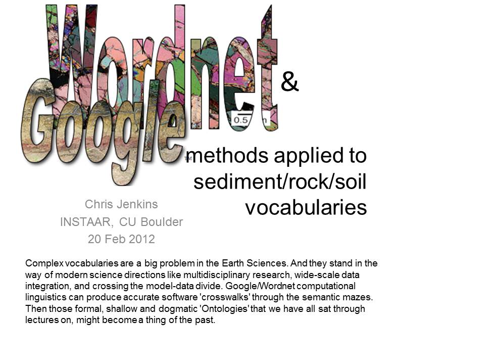
- Google ® & Wordnet ® methods
applied to sediment/rock/soil vocabularies. Monday 20 Feb 2012, INSTAAR Monday Seminar, Boulder CO, USA. (Handbill)
- Seafloor
Sediments: Unlocking the Information from the Word-based Data-sets. July 2009, LDEO, Columbia Univ, NY, USA.
|
|
