 |
 |
|
Example Visualizations |
Contents
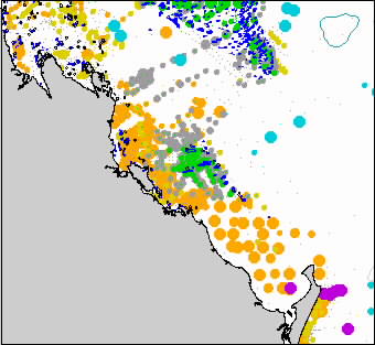
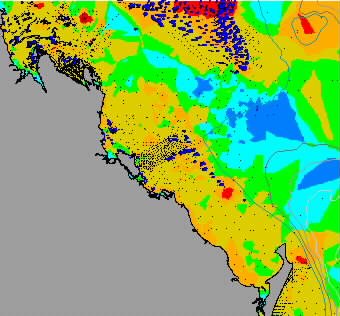
| Point maps Grid maps |
The purpose of these pages is to show how outputs from dbSEABED are used to generate maps in GIS systems. Several users have requested this type of guide. The most useful and most reliable methods are labelled ****.
Some instructions (in italics) are given for their generation using ArcView. Note that in these pages, only non-default instructions are listed, ie only where the user has to intervene.
dbSEABED is not specific to any vendor's GIS. It has been used in GMT, ArcGIS, MapVIEW, MapINFO, ArcVIEW, Surfer and several others.
Most of these maps are drawn for an area at the southern tip of the
Great Barrier Reef. However, the same map types can be generated for
global
to local scales - provided sufficient data is available. To do this,
cellsize,
radius and distance scales may have to be adjusted.
|
|
|
![]()
Chris Jenkins (Email)
INSTAAR, University of Colorado
5-Feb-2002