GEOLOGY
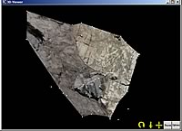
Simple 3D model of joint planes on a roadside bedrock outcrop helps with stability analysis. Boulder Canyon, Colorado.
Outcrop orientations
Example application for geological & geotechnical sciences.
Terrestrial photogrammetry is an ideal method to obtain measurements of position and orientation of features which are inaccessible or hazardous to reach for direct measurements.
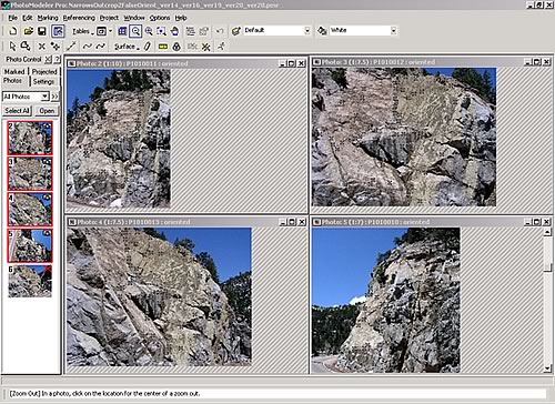
Reference points on the outcrop are mapped onto a series of hand-held photographs taken with a calibrated conventional camera.
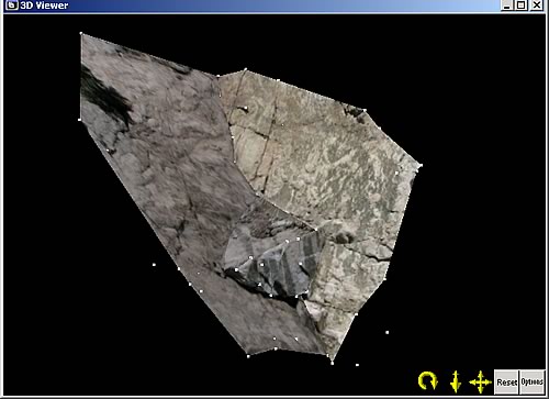
Three-dimensional model of selected joint planes in the outcrop.
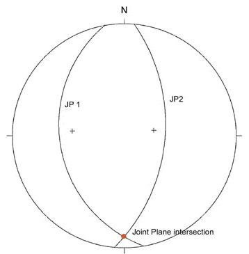
Stereonet plot of orientation of planes used to determine intersection vector for block sliding analysis (Equal angle projection, lower hemisphere).